Lancaster
Your Local News for Lancaster, Pennsylvania
Subscribe
Subscribe
Wednesday, sep 30
73°
Breaking News
Your Community
On Your Side
National Interest
Trending
Events
Weather
Obituaries
Jobs
Advertise
Find Your Daily Voice
GO
Lancaster
Subscribe
Breaking News
Your Community
On Your Side
National Interest
Trending
Events
Weather
Obituaries
Legal
Tags
Jobs
Shop
Sponsored Content
Support Us
Home
About us
All sites
Advertise with us
Contact us
Terms of use
Privacy policy
Code of ethics
Site Map
© 2026 Cantata Media
73°
Wednesday, sep 30
Weather
Strong Storms With Heavy Rain, Gusty Winds Taking Aim At Region: Here's What's Coming
A new storm system accompanied by locally heavy rain, gusty winds, frequent lightning, and possible flash flooding will sweep through the region before things heat up for the rest of the week. Storm activity on Tuesday, July 25, will start from west to east in the early afternoon and continue through the evening, according to the National Weather Service. "Due to the copious amounts of moisture in the atmosphere and weak steering winds, any shower or thunderstorm has the potential to produce localized flooding downpours into Tuesday," according to AccuWeather Senior Meteorologist Dan Pydno…
Weather
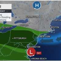
Severe Flood Threat: Intense Downpours Forecast This Weekend Across Northeast
The Northeast is in store for another rainy weekend, this time with a possibility of flooding. According to AccuWeather meteorologists and the National Weather Service, severe downpours are posing a threat to the region. Strong to severe storms were expected across the region Friday, afternoon, July 14, and continue over the course of the weekend, the National Weather Service says. Showers and t-storms, a few of which could be severe, are likely mainly during the afternoon & evening hours the next... Posted by US National Weather Service Baltimore/Washington on Friday, July 14, 20…
Weather
Once In 1,000 Years Flood Leaves Residents Underwater In Eastern PA (
Photos
)
Days after a "1,000-year flood" drenched portions of the Northeastern US over the weekend, Berks County residents impacted by the rainfall are beginning to rebuild. Heavy downpours from a powerful storm system have left communities throughout the region in disrepair and have killed at least one person in New York state, Daily Voice has reported. In Berks, residents are taking to GoFundMe to raise money to undo the damage. Israel Fuentes of Reading says his family's entire basement was flooded under four feet of water during the storm. While he, his wife, and their three children are sa…
Weather
Heatwave
? Temps Could Feel As Hot As 105 Degrees Across East Coast This Week
July is supposed to be hot. But this? It's abnormally hot. Parts of the Northeast are experiencing the first heatwave of the year this week, with real-feel temps at 90 or above three days in a row, according to AccuWeather. That could be the case in Philadelphia, where temps hit 90 on Monday, July 3, and then 88 on Tuesday, July 4. In Washington DC, temps hit 92 and 93 degrees. "Because the 30-year average high temperature has crept upward in recent decades in the nation's capital, the criteria for a heat wave should probably be more like the low to mid-90s for a heat wave, rather than t…
Weather
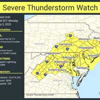
Severe Thunderstorms, 75 MPH Winds, Lightning Threaten New Jersey
A severe thunderstorm watch was issued by the National Weather Service across parts of New Jersey and Pennsylvania Monday, July 3. Hail the size of a ping pong ball, wind gusts up to 75 miles per hour and frequent lightning were all being forecast until 10 p.m. While North and Central Jersey are likely to see only heavy rain, parts of South Jersey and Greater Philadelphia could see more damaging storms, AccuWeather predicts. Severe storms Monday, July 3.AccuWeather Meteorologist Joe Cioffi noted elevated tornado risk in Central Jersey, and severe risks for isolated thunderstorms for mu…
Weather
Smoky Skies To Stay For Summer? Forecasters Say More Hazy Days Are Ahead
The July 4th weekend has arrived, but chances are the smell of smoke outside isn't coming from barbecues — and according to forecasters, there's even more ahead. The air quality on Saturday, July 1 was slightly better than it was earlier in the week, with AQIs average in the 120s and code orange and yellows issued — as opposed to purple and red — across the region. Slowly, slowly, the smoke was starting to disperse. However, AccuWeather Senior Meteorologist Brett Anderson is confident, it will be back. "I do believe this will go down as the summer of smoke and haze for much of Canada and …
Weather
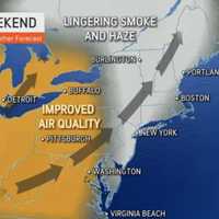
Incoming Storm Means Slight Air Quality Improvement Along East Coast, Forecasters Say
A weekend storm could slightly help improve the Canadian wildfire smoke still lingering along the East Coast, meteorologists are saying. While skies will be sunny with a high in the mid-80s on Friday, June 30, they'll also be hazy for most of the day, according to the National Weather Service. The Air Quality Index remained in the triple digits along East Coast of 9:15 a.m., with code red issued across much of the area. In Pittsburgh, air quality levels remained very unhealthy, according to AccuWeather's Plume Labs. Worst air quality in this batch is just northwest of us and some spots…
Weather
Code
Purple
: Air Quality Extremely Unhealthy In Pittsburgh Area
Air quality levels were continuing to worsen across Pennsylvania Thursday, June 29, due to the Canadian wildfire smoke. According to AirNow.gov, the Air Quality Index (AQI) as of 8 a.m. in Pittsburgh had reached 238 — code purple. In other words, extremely unhealthy for any group, especially those with sensitivities. AQI levels in greater Philadelphia were at 162. Spotty showers have tapered off. We'll be precip-free for the next 24 to 36 hours. Lows tonight will be a few degrees... Posted by US National Weather Service Philadelphia/Mount Holly on Wednesday, June 28, 2023 Residents we…
Weather
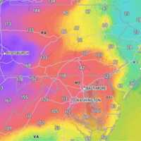
Air Quality Quickly Worsening As Wildfire Smoke Returns
Another wave of Canadian wildfire smoke is making its way to the East Coast — and things were already not looking great as of Wednesday, June 28. Air quality index (AQI) values were in the triple digits in Philadelphia, Washington DC, and Baltimore as of Wednesday afternoon, AccuWeather says citing Plume Labs (see map above). The AQI in Pittsburg was particularly bad, with levels reaching 285. Click here to watch the skyline vanish. ALSO SEE: Philadelphia Air Quality Hits Code Red Due To Canadian Wildfire Smoke, Officials Warn Worst day of smoke from the Canadian wildfires we’ve had y…
Weather
Storms With Possibility Of Isolated Tornadoes To Threaten East Coast
Severe storms with the possibility of isolated tornadoes will be threatening the East Coast Monday, June 26, and will be followed by at least two more days of stormy weather, meteorologists say. Damaging winds, flash flooding, and hail are all possible by late in the afternoon Monday, forecasters are predicting. Hail could be around 1 inch in diameter, the National Weather Service said in a Hazardous Weather Outlook statement issued early Monday morning. A moderate threat was issued across North Jersey, the Poconos, and Central Pennsylvania, while a high threat was issued in South Jersey,…
Weather
Here's Cindy: New Tropical Storm Develops In Active Atlantic
It's starting to get crowded in the Atlantic basin. A brand-new tropical storm has formed just as an earlier system, Bret, continues its westward movement: Meet Cindy. As of around midday Friday, June 23, the center of Tropical Storm Cindy was about 900 miles east of the Lesser Antilles, according to the National Hurricane Center. Cindy is moving toward the west-northwest at around 16 miles per hour and this general motion is expected to continue over the next few days. Maximum sustained winds have increased to nearly 50 mph with higher gusts, the hurricane center sai…
Weather
Separate Rounds Of Thunderstorms Take Aim On Region
Bouts of rain showers and thunderstorms heading to the region are expected to make up for the abnormally-dry end of spring and start to summer. There will be scattered showers throughout the day on Thursday, June 22, which will be cooler with a high temperature in the mid-60s, according to the National Weather Service. About a quarter of an inch of precipitation is possible. Conditions will then become more stormy starting on Friday, June 23, which will be warmer and more humid with a high temperature in the mid-70s. See thunderstorms and rain being forecast along the East Coast.AccuW…
Archive