Subscribe
74°

Ping Pong-Sized Hail, 70 MPH Winds Threaten North Jersey, Lehigh Valley
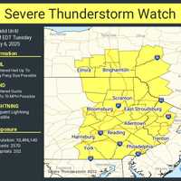
A Severe Thunderstorm Watch is in effect until 8 p.m. Tuesday, May 6, for parts of New Jersey and Pennsylvania, the National Weather Service Storm Prediction Center said.
Residents in Philadelphia, Trenton, Allentown, Reading, and across North and Central Jersey are impacted, the NWS said.
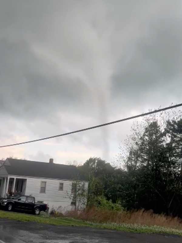
“Isolated thunderstorms have developed over portions of the region,” the National Weather Service said in a Tuesday afternoon update. “The primary threat will be for hail and damaging winds across eastern PA and northern/central NJ.”
Threats include:
Scattered hail up to ping-pong ball size
Wind gusts …
Possible Tornados, High Winds, Severe Storms Threaten Pennsylvania
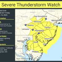
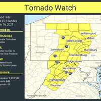
A powerful storm system moving through the East Coast is expected to bring severe thunderstorms, strong winds, and the possibility of isolated tornadoes to parts of New Jersey and Pennsylvania late Sunday, March 16, into the evening, forecasters say.
According to the National Weather Service (NWS) and AccuWeather, the storm poses several risks, including:
Damaging wind gusts between 55-65 mph, with isolated gusts up to 90 mph possible.
Heavy rain leading to flash flooding in low-lying areas.
Possible isolated tornadoes, particularly in eastern Pennsylvania and the Delmarva region.
"Widespr…
50+ MPH Winds, Thunderstorms To Slam NJ, PA: Here’s When It Hits
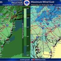
A strong storm system will sweep across New Jersey and Pennsylvania on Wednesday, March 5, delivering damaging winds, torrential rain, and possible severe thunderstorms, according to the National Weather Service (NWS) Mount Holly.
Wind gusts between 45 and 50 mph are expected across much of the region, with higher gusts nearing 60 mph possible along the Jersey Shore and Delmarva Peninsula, forecasters said.
“The heavily populated I-95 corridor will finally experience the gusty winds on the final day of this multi-day episode on Wednesday, as the storm intensifies and moves into Canada,” Acc…
60 MPH Winds, Heavy Rain Will Batter PA: Outages, Flooding Possible
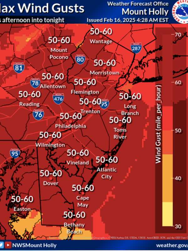
A powerful storm system is sweeping across New Jersey on Sunday, Feb. 16, bringing damaging winds, heavy rain, and the potential for flooding and power outages, according to the National Weather Service (NWS). The strongest winds are expected to peak in the afternoon into the evening, with gusts between 50 and 60 mph hitting many areas across the state.
The hardest-hit areas for wind gusts include Morristown, Flemington, and Trenton, where winds are forecasted to reach 50 to 60 mph through tonight. Similar gusts are expected in greater Philadelphia, the Lehigh Valley, Vineland, and Atlantic …
Foot Of Snow Could Wallop Parts Of PA, Winter Storm Warning In Effect
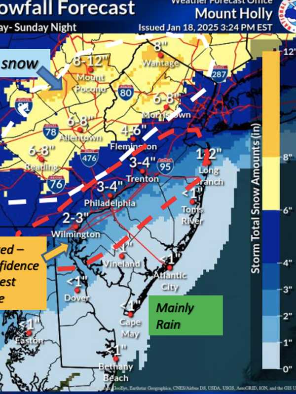
New Jersey Gov. Phil Murphy declared a State of Emergency beginning Sunday morning, Jan. 19, right as the National Weather Service released a brand-new snowfall forecast for the winter storm heading toward the region.
CLICK HERE FOR LATEST FORECAST AS OF 9 AM JAN. 19, 2025.
The storm will begin with scattered showers and a low of 26 degrees Saturday night, Jan. 18, the NWS said. By Sunday afternoon, snow is expected to begin after 1 p.m., with temperatures hovering around 30 degrees. The snow could be heavy at times, with rates exceeding 1 inch per hour, especially in areas northwest of the…
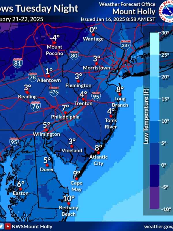
Arctic Blast Will Follow Snow Showers Across PA With Temps We Haven't Seen In Years, NWS Says
Light snow showers are forecast to begin Thursday afternoon, Jan. 16 across parts of New Jersey and Pennsylvania, potentially creating slippery conditions during the evening commute, according to the National Weather Service (NWS).
A Hazardous Weather Outlook has been issued for several northeast New Jersey counties, including Passaic, Hudson, Bergen, Essex, and Union, with snowfall set to begin after 4 p.m.
Most areas are expected to see less than one inch of snow, though localized accumulations of up to two inches are possible in parts of eastern Pennsylvania near and north of …
6 To 8 Inches Of Snow Could Fall In Parts Of NJ, PA: Here's The Latest Winter Storm Forecast
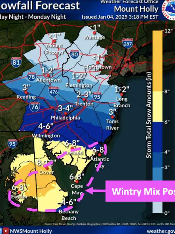
The first significant snowstorm of 2025 is expected to hit the region Sunday night, Jan 5, bringing up to 8 inches of snow to parts of New Jersey and Pennsylvania, according to the National Weather Service.
The storm is expected to begin late Sunday night, continuing through Monday, Jan. 6 before tapering off into Monday night.
Snow accumulations are forecast across the region, with the highest totals predicted in South Jersey (Vineland, Atlantic City, Cape May) and Philadelphia, where snowfall could reach 6 to 8 inches, new weather maps show.
Greater Philadelphia could see 3 t…
Freezing Rain To Glaze Roadways With Ice: Winter Weather Advisories Issued Across NJ, PA
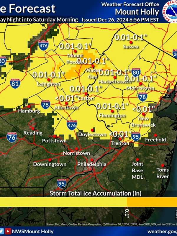
A Winter Weather Advisory has been issued for parts of New Jersey and Pennsylvania as freezing rain is expected to create icy road conditions Friday night, Dec. 27 into Saturday morning, Dec. 28, according to the National Weather Service (NWS).
The advisory is in effect from 7 p.m. Friday to Saturday. Ice accumulations of up to one-tenth of an inch are anticipated in Sussex, Warren, and Morris counties, in NJ, and Lehigh and Northampton counties, in PA.
"Very slippery sidewalks, roads, and bridges are possible," the NWS warned. Motorists are urged to slow down and exercise caution while dri…